
Atlantic Ocean Road: Norway’s Pure Magic Journey
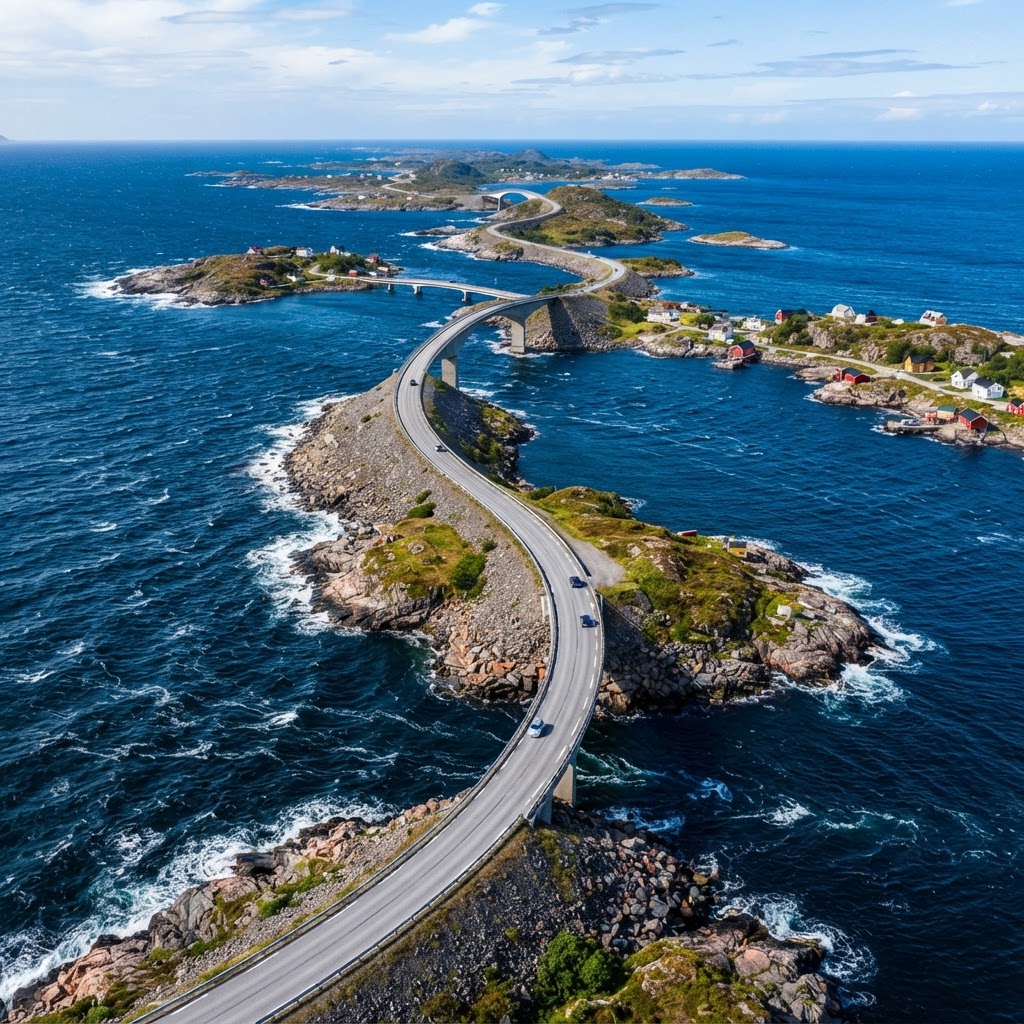
The Atlantic Ocean Road, known locally as Atlanterhavsvegen, is an 8.3-kilometer stretch of County Road 64 in Norway that connects the island communities of Averøy with the mainland via eight dramatic bridges. It is globally famous for its unique “ocean-level” design that creates the illusion of driving directly on the surface of the North Atlantic.
The Engineering Marvel of the Atlantic Ocean Road
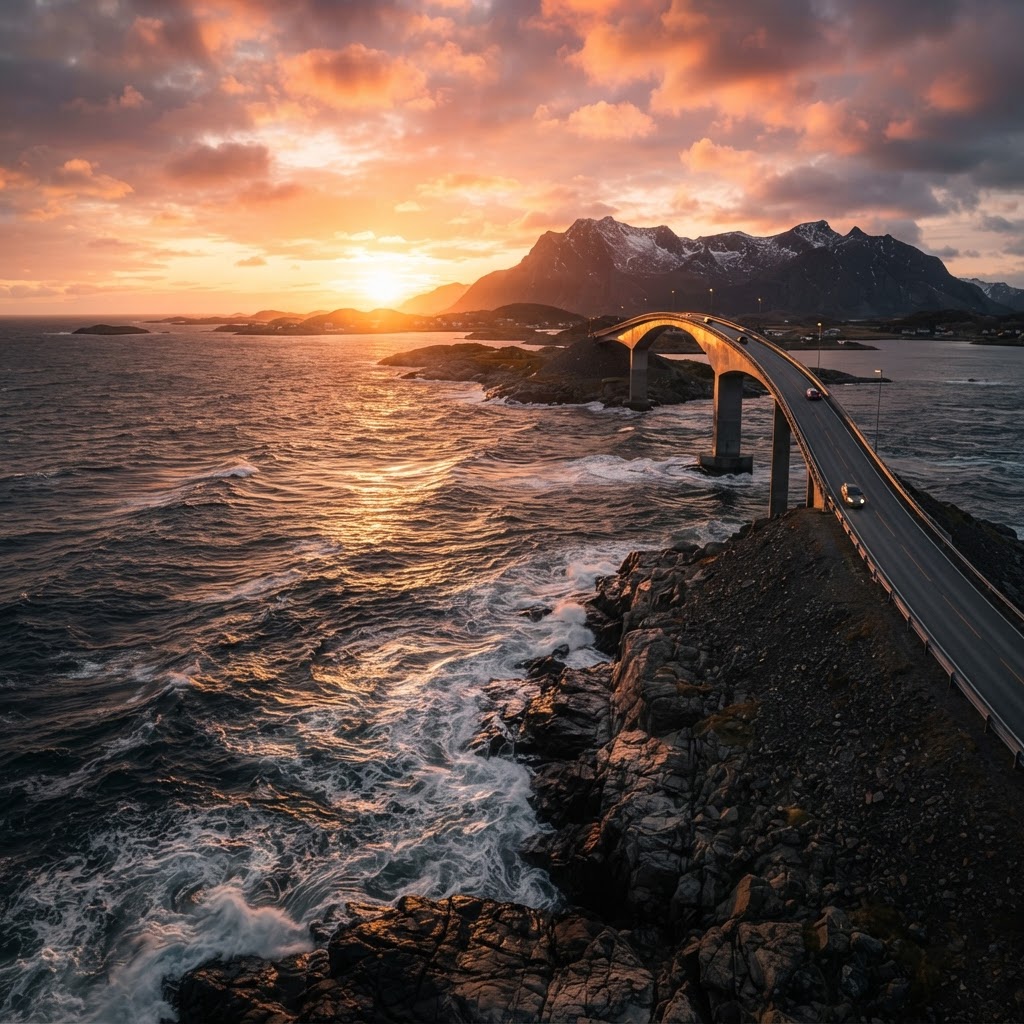
Completed in 1989 after six years of intense construction, the Atlantic Ocean Road serves as a masterclass in resilient civil engineering designed to withstand the brutal environment of the Norwegian coast. During the construction period, workers faced twelve distinct hurricanes, which tested the structural integrity of the foundations long before the road even opened to the public. The design philosophy centers on harmonious integration with the archipelago, utilizing eight bridges to span the rugged islands. The most iconic structure, the Storseisundet Bridge, reaches a peak height of 23 meters above the sea and utilizes a unique cantilever design. This specific architecture creates a famous optical illusion from southern angles, making it appear as though the road abruptly ends in the open ocean. Beyond mere aesthetics, the road is engineered to survive massive hydraulic pressure from storm surges and constant salt-spray corrosion. By linking the small fishing communities of Averøy to the mainland, the road transformed local logistics while simultaneously becoming a world-renowned destination. Every bridge and causeway utilizes high-strength concrete and advanced reinforcement techniques to ensure that this vital infrastructure remains operational even during the region’s frequent extreme weather events. The durability of the road allows it to handle heavy traffic while maintaining a seamless connection through one of the most volatile coastlines in the world, serving as both a functional highway and a feat of human perseverance against nature.
Comparison: Engineering Specifications
Planning Your Ultimate Norwegian Road Trip
Planning a visit to the Atlantic Ocean Road requires acknowledging the extreme variability of Norwegian coastal weather, which can shift from clear skies to gale-force winds in minutes. Most travelers arrive via the towns of Kristiansund (25 km away) or Molde (47 km away), both of which provide excellent logistical support, car rental services, and accommodation options. The drive itself is relatively short—taking roughly 15 to 20 minutes of continuous driving—but most visitors allocate at least three to five hours to fully explore the designated rest stops and photograph the bridges. For those traveling in summer, the Midnight Sun provides nearly 20 hours of daylight, allowing for photography sessions as late as midnight. In contrast, visiting between September and November offers the highest chance of seeing the ocean during a storm, providing a dramatic, high-stakes atmosphere for travelers. When preparing your vehicle, ensure your rental car has modern tires and high-quality windshield wipers, as the coastal salt spray can obscure visibility quickly. Travelers should prioritize stops at the Eldhusøya visitor center, which features parking facilities and a modern cafe. Always keep a charged power bank, as the cold temperatures can drain lithium-ion batteries faster than anticipated in this region. Whether you are driving a luxury vehicle or a campervan, the road is well-maintained and accessible year-round, though closures can occur during severe winter weather alerts.
Seasonal Travel Guide
Unforgettable Sights Along the Route
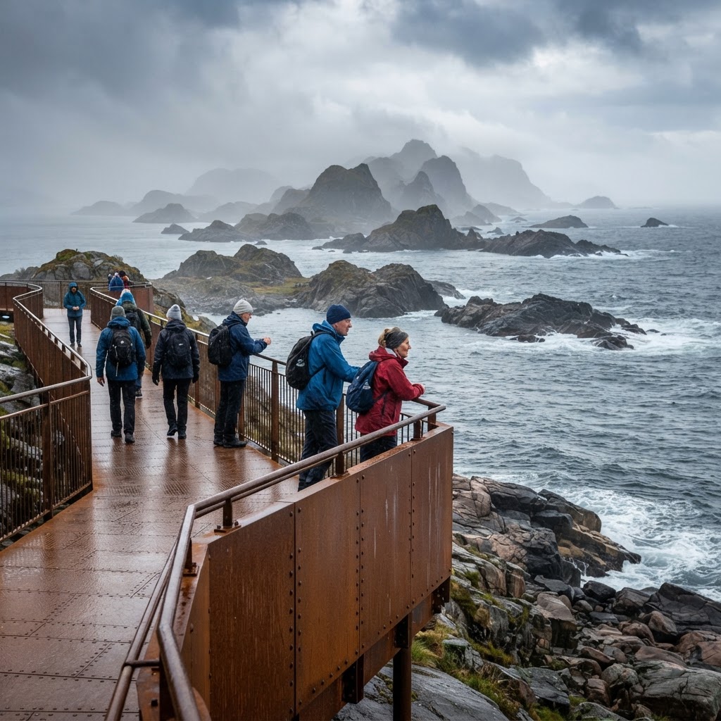
The Atlantic Ocean Road is designed with multiple observation points and rest areas, ensuring that visitors can safely dismount their vehicles to experience the archipelago’s natural beauty. The Eldhusøya Boardwalk stands out as the premier stop; this suspended steel structure follows the natural terrain of the island, providing a 360-degree vantage point that overlooks the bridges and the churning Atlantic waves. Beyond the boardwalk, the surrounding waters are a haven for local biodiversity. Anglers frequent the deep-water currents beneath the bridges, where the nutrient-rich water attracts significant fish populations, particularly cod and coalfish. Birdwatchers should keep binoculars ready, as the rocky outcrops are frequently visited by white-tailed sea eagles and various species of gulls. For those seeking cultural history, the nearby island of Averøy offers access to the Kvernes Stave Church, a fascinating wooden structure dating back to the 14th century, which offers a stark contrast to the modern steel of the highway. Travelers can also explore the local harbor areas, which retain the traditional architecture of the Norwegian clipfish industry. This area serves as a primary hub for maritime history and serves as a reminder of how the road physically bridged the gap between modern travel and traditional seafaring communities. By utilizing the official parking areas, tourists can explore these sights without blocking traffic, ensuring a safe experience for everyone on the road.
Comparison: Why This Road Stands Out
While Norway is famous for its scenic routes, the Atlantic Ocean Road stands out for its unique “ocean-level” experience. Unlike mountain passes that offer high-altitude vistas, this route places you directly in the heart of the sea spray.
Embracing the Spirit of Adventure
The thrill of driving the Atlantic Ocean Road lies in the vulnerability one feels while navigating the bridges. As the road curves sharply and dips toward the water, there is a tangible sense of adventure that is difficult to find elsewhere. It is an experience that reminds us of the power of nature and the ability of human engineering to exist in tandem with it. Photographers often flock to the Storseisundet Bridge during the “golden hour” when the light catches the curves of the bridge and the churning water below. To get the perfect shot, look for the designated pull-off areas that provide a clean line of sight toward the arch. Remember that safety comes first—do not attempt to walk on the road itself during high traffic.
Nearby Attractions to Enhance Your Trip
If you find yourself with extra time, the region surrounding the Atlantic Ocean Road is rich with history and culture. A short drive away lies the town of Kristiansund, known for its colorful wooden architecture and historical significance in the clipfish industry. If you are traveling in Norway, you can easily combine your visit to the Atlantic Ocean Road with the world-famous Trollstigen mountain pass. This combination offers the ultimate contrast: the deep, calm waters of the coast and the dizzying heights of the mountain hairpins. It is a two-fold experience that captures the essence of Norwegian geography.
FAQ
Q: Is the Atlantic Ocean Road free to drive?
Yes, the Atlantic Ocean Road is entirely free to drive. Since 1999, the road has been toll-free, allowing tourists to travel the route as many times as they like without incurring additional travel costs or congestion charges.
Q: How long does it take to drive the Atlantic Ocean Road?
The drive itself takes approximately 20 minutes if you do not make any stops. However, most visitors should budget at least 3 to 5 hours to account for stops at the observation points, the Eldhusøya boardwalk, and photography sessions at the Storseisundet Bridge.
Q: What is the best time of year to visit the Atlantic Ocean Road?
The best time depends on your preference; summer (June-August) offers the best weather and long daylight hours, while late autumn (October-November) is ideal for witnessing dramatic, stormy seas. Regardless of the season, check local weather reports before departing.
Q: Is the Atlantic Ocean Road dangerous to drive?
Driving the Atlantic Ocean Road is generally safe, as it is a well-maintained public highway. However, drivers should exercise extreme caution during high winds and storms, as salt spray can reduce visibility and the open causeways offer little shelter from strong gusts.
Q: Can I take a bus to the Atlantic Ocean Road?
Yes, local bus services operate between Kristiansund and Molde that pass through the Atlantic Ocean Road. While this is an affordable way to see the route, it does not allow for the same flexibility as a private vehicle for stopping at scenic viewpoints.
Practical Insider Tips for the Drive
Do not attempt this drive in a standard campervan during autumn unless you are a confident driver. The wind gusts on the exposed causeways can push high-profile vehicles dangerously close to the railings. Rent a compact car instead to maintain better stability during the frequent coastal squalls.
Stop at the Eldhusøya rest area early in your trip. It features a floating walkway that provides a 360-degree view of the bridges and the surrounding archipelago. Most tourists rush across the bridges, but this path allows you to capture the scale of the construction without risking your safety on the road shoulders.
Strategic Itinerary: A Step-by-Step Plan
Start your journey in Molde early in the morning to beat the tour buses. Head north toward Kristiansund and aim to cross the Storseisundet Bridge around mid-morning when the light hits the water at its brightest. If you arrive too late in the afternoon, the sun often sinks behind the western islands, plunging the bridges into heavy shadow.
- Morning: Depart Molde at 8:00 AM for the scenic coastal route.
- Late Morning: Spend one hour exploring the Eldhusøya trail and viewpoints.
- Lunch: Stop at a local cafe in Averøy to eat fresh Bacalao, a traditional dried cod dish.
- Afternoon: Visit the nearby Kvernes Stave Church before heading back toward the mainland.
Avoiding Common Mistakes
Many travelers make the mistake of driving the road only once. The experience looks entirely different when driving from the north compared to the south. Take the time to drive the entire 8.3-kilometer stretch, turn around at the designated junctions, and drive it back to see the bridge angles from both directions.
Another common error is ignoring the weather alerts provided by local traffic apps. If the Norwegian Public Roads Administration issues a yellow warning for wind, pull over at a sheltered harbor town. Trying to photograph the waves crashing over the bridges in gale-force winds often leads to ruined camera gear or minor accidents.
Seasonal Comparison: When to Visit
June through August offers the safest road conditions and the longest daylight hours. You will share the road with many other tourists, but the access to hiking trails and island viewpoints is at its peak. Prices for rental cars and local guesthouses are roughly 30 percent higher during this window.
September through October offers dramatic, moody photography opportunities with massive ocean swells. However, the risk of road closures increases significantly due to intense storm systems. Only visit during this time if you have a flexible schedule and can wait out a storm in a local hotel.
Road Trip Checklist
- Download the Statens Vegvesen traffic app for live road alerts.
- Pack a windproof, waterproof shell jacket even if the sun is shining.
- Bring a polarizing filter for your camera to cut the glare on the Atlantic waves.
- Carry extra Norwegian Krone in cash for small ferry crossings or local roadside stalls.
Frequently Asked Questions
Is the road safe for inexperienced drivers?
Yes, the road is paved, wide, and well-marked with guardrails, but the narrow bridges can feel intimidating when large buses approach from the opposite direction. Keep your speed steady, stay in your lane, and use the designated pull-offs if you feel overwhelmed by the height or the proximity to the water.
Can I walk or cycle across the bridges?
It is legally permitted, but it is not recommended during high winds or heavy traffic. Use the designated footpaths where available, but stay vigilant, as cars often move quickly to finish the drive before the weather changes.
Are there tolls on the Atlantic Ocean Road?
No, the road became completely toll-free in 1999. You can drive back and forth as many times as you like without paying any additional fees or bridge taxes.
Leave a Reply