
The Road That Curves Through the Ocean: A Norway Guide
The Atlanterhavsvegen, or Atlantic Ocean Road, is a 8.3-kilometer stretch of County Road 64 in Norway known for its dramatic bridges that appear to curve directly into the ocean. It connects the municipalities of Averøy and Eide, offering travelers a unique driving experience across eight low-lying bridges built on a series of small islets.
The Engineering Behind the Marvel
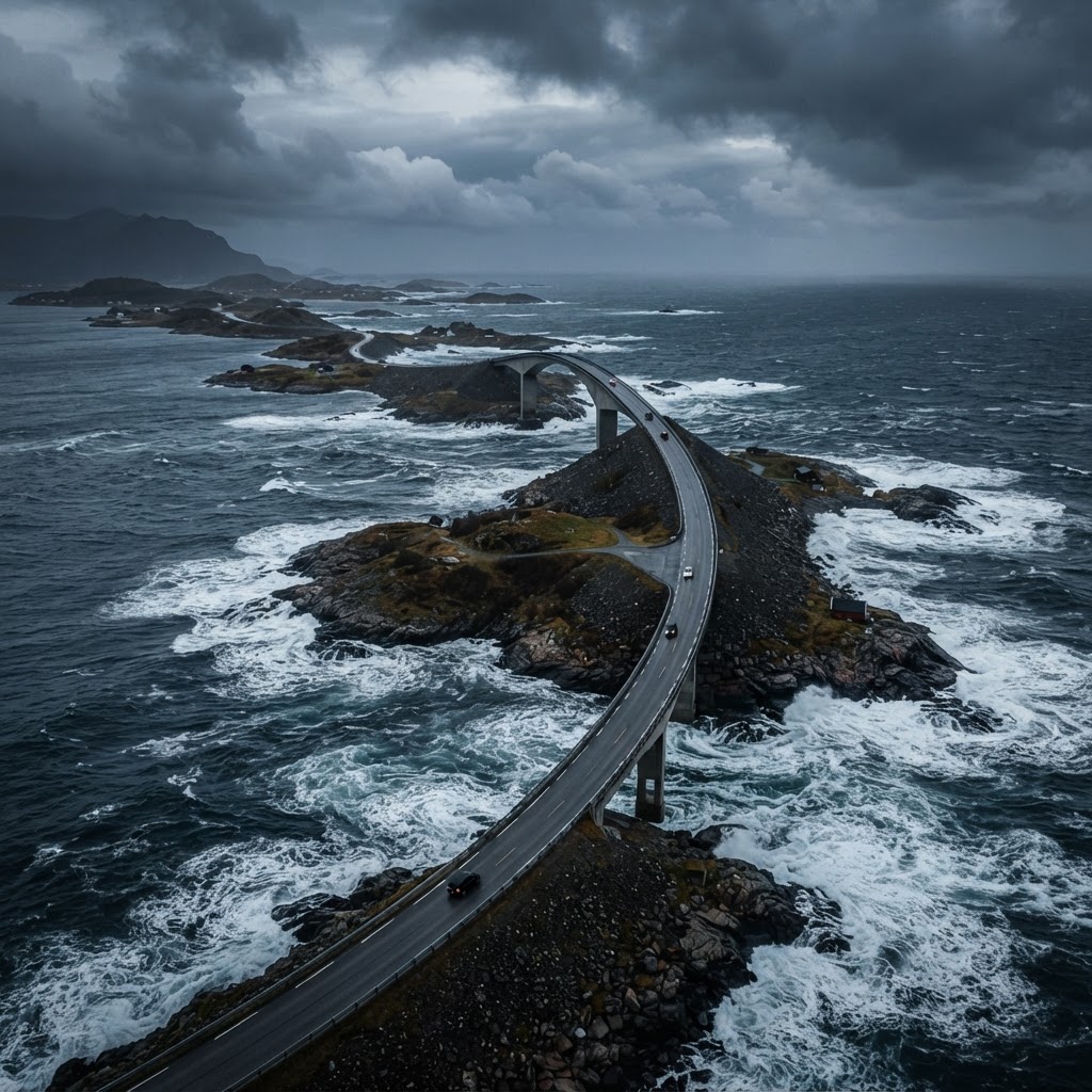
The construction of the Atlantic Ocean Road was a monumental feat of civil engineering that required precise technical innovation to combat the volatile Norwegian Sea. Completed in 1989 after six years of construction, the project utilizes eight bridges, with the iconic Storseisundet Bridge serving as the centerpiece. This cantilever bridge rises 23 meters above the water at its highest point, creating an optical illusion where the road appears to end abruptly. Engineers specifically designed the infrastructure to withstand “100-year storms,” incorporating reinforced concrete piles driven deep into the seabed to resist hurricane-force winds and consistent wave impact. The project cost approximately 122 million NOK at the time, a significant investment that transformed regional connectivity by replacing unreliable ferry links with a permanent, all-weather thoroughfare. This seamless integration of modern infrastructure with the untamed, rugged skerries of the coastline highlights how Norway successfully tamed one of the most challenging marine environments in Europe.
Planning Your Visit to Atlanterhavsvegen
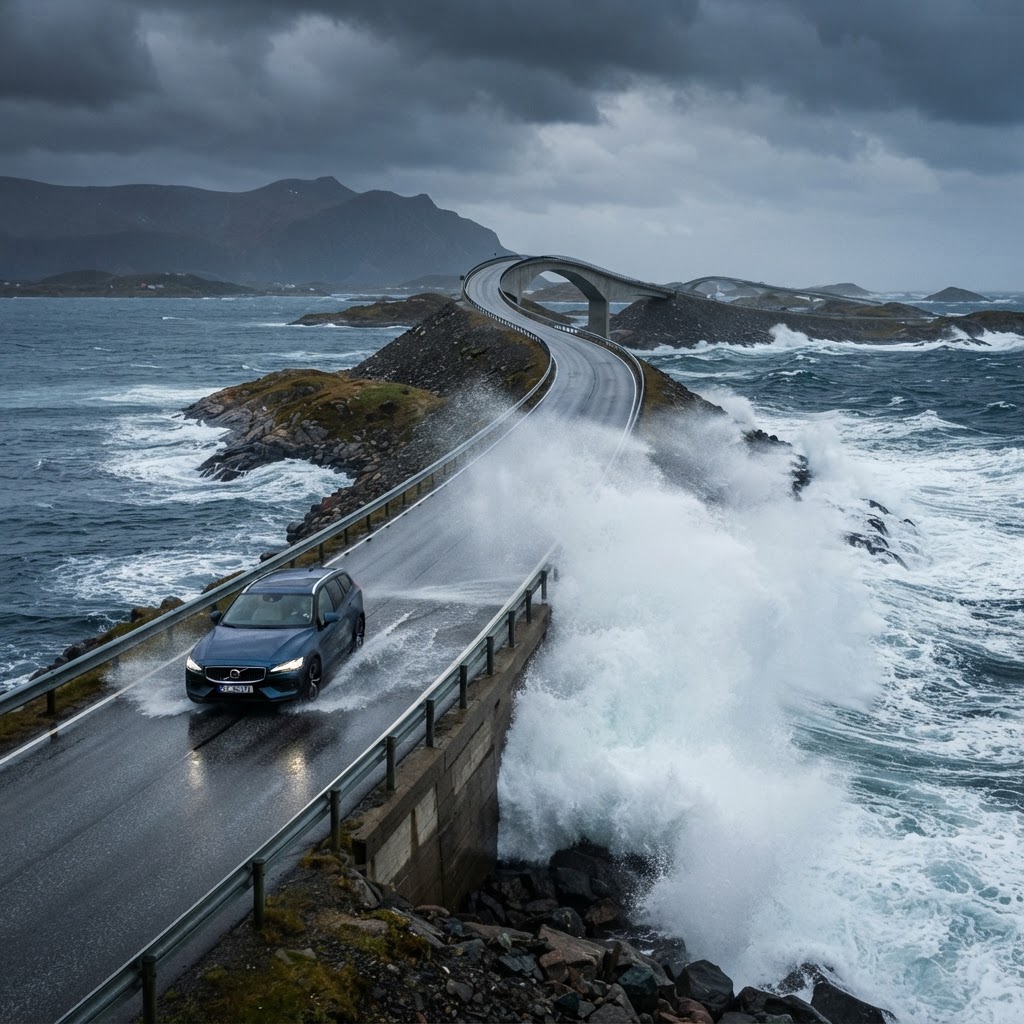
Timing your visit to the Atlantic Ocean Road depends heavily on whether you prioritize serene scenic drives or high-intensity coastal photography. Summer (June to August) offers 20 hours of daylight and stable road conditions, making it ideal for road trippers exploring Norway’s wider fjord region. Conversely, autumn and winter provide the most dramatic photography opportunities, as storm systems frequently trigger massive swells that wash over the bridge decks. Regardless of the season, travelers must adhere to specific logistical requirements to ensure a smooth journey.
| Season | Weather Profile | Best For | Requirement |
|---|---|---|---|
| Summer | Mild/Sunlight | Sightseeing | Advance Booking |
| Winter | Stormy/Dark | Photography | Winter Tires |
| Shoulder | Variable | Hiking/Nature | Flexible Plans |
- Rent a car with good winter tires if traveling between October and April.
- Dedicate at least three hours to allow for multiple photography stops.
- Book accommodation in nearby Kristiansund or Molde well in advance.
- Check the local weather forecasts daily, as gale-force winds can impact road safety.
Essential Gear for Coastal Photography
If you are visiting for the scenery, ensure you have weather-sealed camera equipment. The salt spray can be corrosive, and the wind is rarely calm. A sturdy tripod is mandatory if you hope to capture long-exposure shots of the crashing waves against the bridge supports.
A Journey Through Coastal History
Historical maritime reliance defined this region long before the Atlantic Ocean Road existed, with local economies built almost entirely on fishing and coastal trade. For centuries, the island communities of Averøy were isolated, accessible only by small boats that navigated the treacherous currents of the Hustadvika bay. The completion of the road in 1989 fundamentally shifted the local demographic, moving the area from a series of remote fishing outposts to a premier stop on the Norwegian Scenic Route network. Today, visitors can still explore remnants of this history at the Kvernes Stave Church nearby or within the small, charming villages that dot the shoreline. These settlements provide a peaceful, architectural contrast to the high-speed thrills of the ocean-side drive, offering a glimpse into the resilient lifestyle of the Norwegian coastal people. By driving the route, you are essentially tracing the evolution of Norway’s transport infrastructure from 19th-century maritime survival to 21st-century architectural tourism.
Wildlife and Nature Along the Route
Biodiversity thrives in the unique ecosystem surrounding the Atlantic Ocean Road, where nutrient-rich waters support a diverse array of marine and avian life. Seals are frequently spotted lounging on the low-lying rocks near the bridge supports, particularly during low tide when they hunt for fish in the shallow currents. The sky above the roadway is a prime hunting ground for sea eagles, which are often visible circling the coastal cliffs in search of prey. For birdwatchers, the proximity to the Hustadvika nature reserve makes this an essential stop for observing migratory patterns. The road design specifically respects the natural habitat, allowing visitors to view marine life without the need for intrusive boat tours. Ensure you bring high-quality binoculars, as the distance between the road and the rocky islets provides perfect, undisturbed vantage points for observing these species in their natural environment.
Safety Protocols for the Atlantic Road
Safety is the most critical consideration for drivers navigating the Atlantic Ocean Road, especially given the unpredictable nature of the North Atlantic climate. The road features “drunken” looking bridges—a result of the unique design necessary to span the deep gaps between skerries—which can prove disorienting for inexperienced drivers. During severe storms, the road is subject to closure if wind speeds exceed 20 meters per second, which is common in late autumn. Drivers operating high-profile vehicles, such as camper vans or heavy motorhomes, must exercise extreme caution during gale-force gusts, as the bridge exposure provides no natural windbreak. Adhering to the posted speed limits is mandatory; these limits are strictly enforced to protect pedestrians at photography pull-offs and to ensure vehicle control on the tight, twisting turns. Always monitor the local road traffic service alerts before departure, especially during the winter months when ice accumulation on the bridge decks can turn a simple crossing into a hazardous event.
FAQ
Q: Is the Atlantic Ocean Road toll-free?
Yes, the Atlantic Ocean Road is completely free to drive. While the construction was originally partially funded by tolls, all debt was settled in 1999, making the route accessible to everyone without charge.
Q: What is the best time of year to visit the Atlantic Ocean Road?
For the best photography, visit between September and November to catch the dramatic storm season. If you prefer long days for sightseeing and driving comfortably, June through August provides the best weather and most daylight hours.
Q: Can you walk across the Storseisundet Bridge?
While there are designated footpaths and viewing platforms near the bridges, walking directly on the main traffic lanes of the Storseisundet Bridge is dangerous and prohibited. Use the marked parking areas and pedestrian bridges to view the structure safely.
Q: How long does it take to drive the entire route?
Technically, the road is only 8.3 kilometers long, which takes about 10–15 minutes to drive. However, to fully enjoy the stops, viewpoints, and photography opportunities, most travelers allocate at least three hours for the full experience.
Q: Are there charging stations for electric vehicles nearby?
Yes, Norway is a global leader in EV infrastructure, and you will find multiple charging stations in nearby towns like Kristiansund and Molde. It is recommended to charge your vehicle in these towns before driving the coastal route to ensure range safety.
Leave a Reply