
The Most Instagrammable Road in Norway: Atlantic Ocean Road
The Atlantic Ocean Road, or Atlanterhavsvegen, is widely considered the most Instagrammable road in Norway due to its eight iconic bridges that curve dramatically across the sea. This 8.3-kilometer stretch between Kristiansund and Molde provides unparalleled landscape photography opportunities where modern engineering meets the raw, volatile power of the Norwegian North Atlantic.
The Engineering Marvel of Atlanterhavsvegen
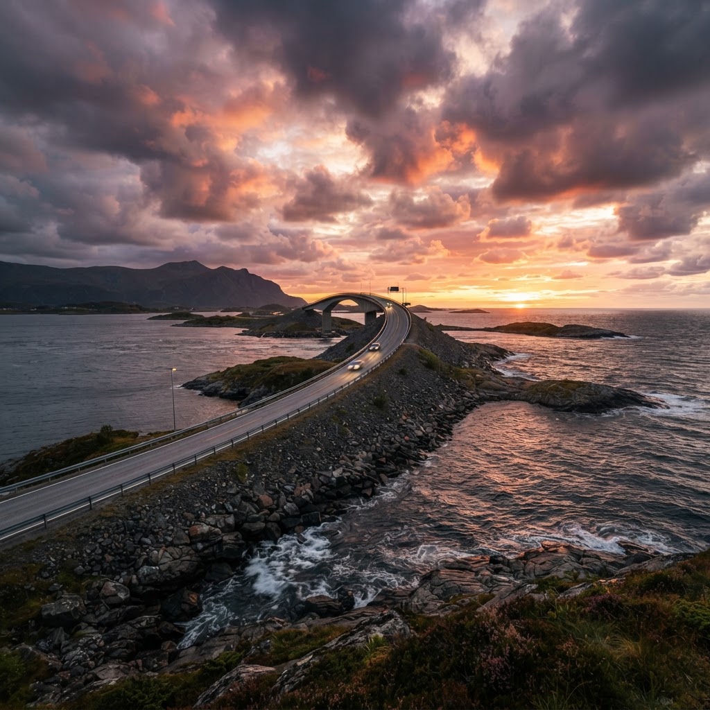
Designated as one of Norway’s National Tourist Routes, the Atlantic Ocean Road spans approximately 8.3 kilometers between the towns of Kristiansund and Molde. Opened on July 7, 1989, the project cost roughly 122 million NOK at the time and consists of eight bridges that connect the archipelago, allowing travelers to traverse the ocean in a way that feels almost supernatural. The most famous structure among these is the Storseisundet Bridge, which provides the most dramatic visual of the entire route. This bridge rises 23 meters above the sea and features a unique cantilevered design that creates an optical illusion of the road ending abruptly when viewed from specific angles. Because the route crosses over open water, it was designed to withstand extreme coastal weather, including hurricane-force winds and massive wave surges. The road has faced over 12 recorded “hurricane-force” storms since its opening, proving that the engineering prowess is as durable as it is aesthetic. For photographers, the bridge is the primary draw, acting as a “vanishing” highway that perfectly captures the isolation and majesty of the Norwegian coastline. The structural integrity and the deliberate, sweeping curves of the bridges are what elevate this public road from a simple transit route to a global icon of civil engineering.
Why it captivates photographers
The road is a photographer’s paradise because it changes personality with every weather shift. On a sunny day, the water is a deep, tranquil turquoise, reflecting the clear blue sky. On a stormy day, the ocean swells crash against the bridge pylons, creating a wild, misty atmosphere that provides an incredible backdrop for landscape photography. The curvature of the Storseisundet Bridge is designed to create a sense of “vanishing into the sea” when viewed from specific angles, which is exactly why it tops the list of the most Instagrammable road in Norway locations.
| Feature | Summer (June – August) | Autumn/Winter (Oct – Feb) |
|---|---|---|
| Lighting | Midnight Sun (Soft/Golden) | Dramatic/Stormy/Dark |
| Road Conditions | Stable/Dry | Potential Ice/High Winds |
| Photography Style | Ethereal Landscapes | Action/Wave Photography |
| Tourist Density | High | Very Low |
Planning Your Ultimate Norwegian Road Trip
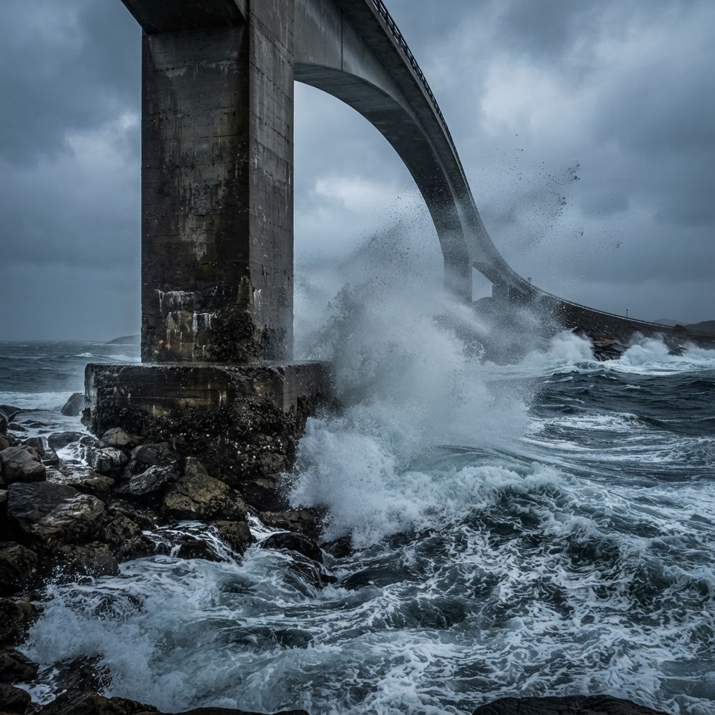
To capture the best shots and experience the road without the heavy congestion of midday tour buses, timing is everything. The Atlantic Ocean Road is open year-round, but the experience varies wildly depending on the season. Summer provides the famous “midnight sun” lighting, which offers soft, golden-hour light that lasts for hours, while autumn and winter bring the dramatic storm surges that make for legendary, high-impact photography. If you are planning a visit, allocate at least 2 to 3 hours for the drive to allow for stops at all four primary viewpoints. During the peak summer month of July, traffic volume can exceed 5,000 vehicles per day, so planning to visit before 9:00 AM or after 7:00 PM is essential to secure parking at the popular Storseisundet lookout. Keep in mind that toll stations on nearby routes may require electronic payment via the AutoPASS system, so ensure your rental car is equipped with a transponder. Always check the official Vegvesen traffic portal for real-time wind warnings, as high winds on the open bridges can occasionally lead to temporary closures for light vehicles or caravans during extreme storms.
Essential gear for your trip
When visiting, ensure you have a wide-angle lens to capture the scale of the bridges. Additionally, a circular polarizer is helpful for managing the glare off the ocean, and a weather-sealed camera body is essential if you plan on shooting during the classic Norwegian coastal rain. Given the high winds often present on the exposed bridges, a sturdy tripod is non-negotiable for those looking to capture long-exposure shots of the crashing waves.
Top Photography Spots Along the Route
While the entire stretch is visually arresting, certain spots are specifically curated for the perfect photo. You will find several designated viewpoints and rest areas equipped with parking facilities. These spots are not just convenient; they are designed to offer the safest and most aesthetic vantage points to admire the connection between the road and the surrounding nature. Each site offers a distinct perspective, ranging from elevated walkways to ground-level wave perspectives.
- Storseisundet Bridge Viewpoint: The most iconic spot where the road appears to end abruptly in the sky.
- Eldhusøya Rest Area: A beautiful architectural path that leads you on an elevated walkway, offering 360-degree views of the bridges.
- Askevågen Viewpoint: A glass-enclosed viewing platform that gives you an unobstructed look at the ocean without getting soaked by the spray.
- Kjeksa: A higher-elevation lookout that allows you to capture the entire length of the road in one frame.
Safety and Practical Considerations
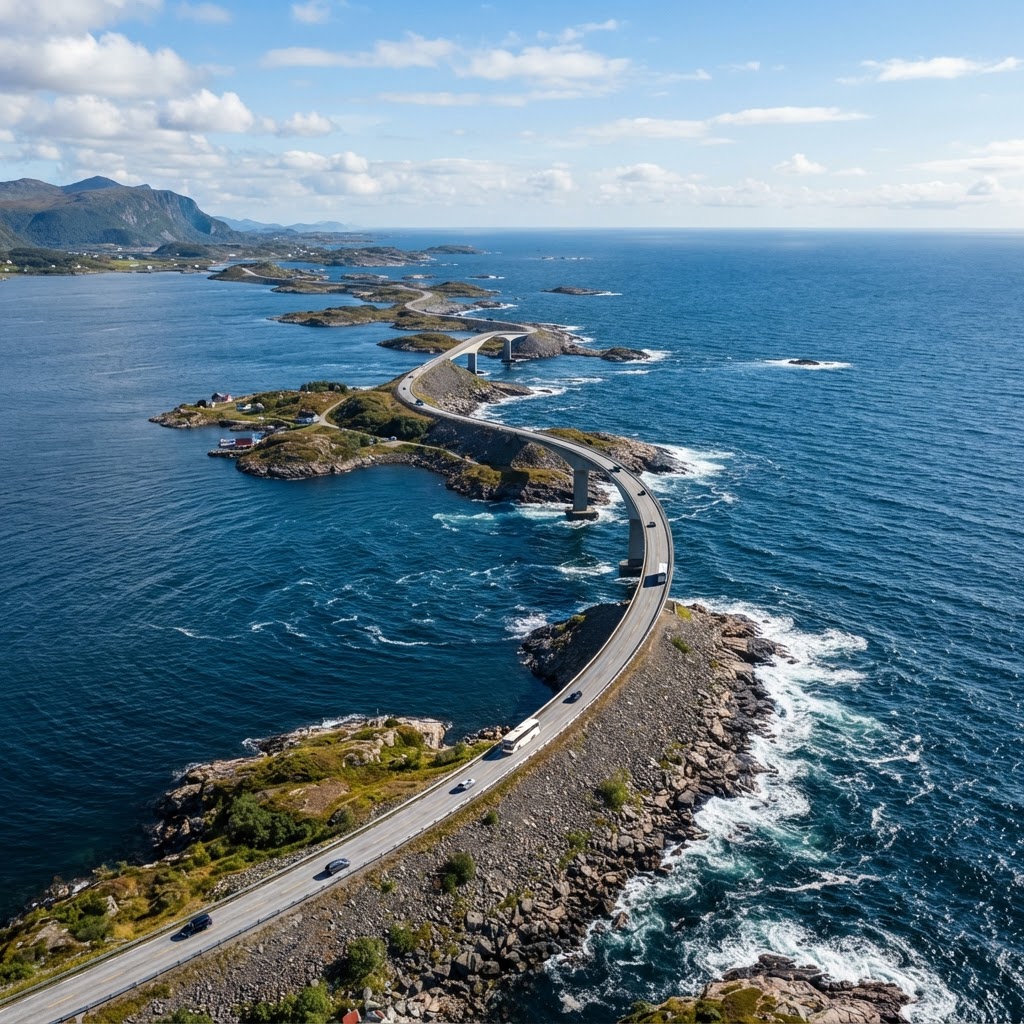
The Atlantic Ocean Road is a public highway, and while it is the most Instagrammable road in Norway, it remains a working infrastructure. Traffic can be busy during the peak tourist season in July and August. Always use the designated parking areas rather than pulling over on the side of the bridge, as it is dangerous for both you and other motorists. Respecting local road regulations ensures that this beautiful site remains accessible and safe for everyone. Be aware that the speed limit fluctuates between 60 km/h and 80 km/h depending on the section, and speed cameras are present in several zones along the coastal route. When walking on designated paths like Eldhusøya, stay within the metal barriers, as coastal gusts can reach speeds of over 100 km/h during stormy weather. If you are driving a rental camper van, ensure you are comfortable with narrow roads and potential tailgating from local traffic, as the route is narrow and lacks a hard shoulder in most areas. Always park in the official lots marked with the “turistveg” sign, which provides free access to public toilets and information boards. Keeping safety as your priority allows for a more relaxed photographic experience, preventing unnecessary fines and ensuring you don’t impede the flow of local traffic.
Beyond the Road: Exploring the Region
If you are traveling through the region, do not limit your experience to just the 8-kilometer stretch of the Atlantic Ocean Road. This area is the gateway to the Romsdalsfjord and the famous Trollstigen mountain pass. Many travelers combine these two iconic routes into a single “Norwegian Coastal and Mountain Expedition.” You can spend a day photographing the curves of the ocean road and the next day climbing the hairpin bends of the mountains, providing a diverse portfolio of images for your travel feed. The nearby town of Bud serves as an excellent base, offering historical WWII bunkers that provide a gritty, industrial contrast to the clean lines of the bridges. Additionally, the city of Molde—known as the “City of Roses”—is only a 45-minute drive away and offers cultural experiences like the Molde Jazz Festival in July. For those interested in deeper regional exploration, the ferry from Molde to Vestnes connects you efficiently to the path toward Geirangerfjord, arguably the most beautiful fjord in the country. This interconnected network of roads allows for a loop route, meaning you won’t have to backtrack on your journey. Combining the coastal road with inland mountain passes provides a comprehensive view of Norway’s geography, transitioning from the raw maritime exposure of the North Atlantic to the sheltered, lush mountain valleys within just a few hours of driving.
Where to stay
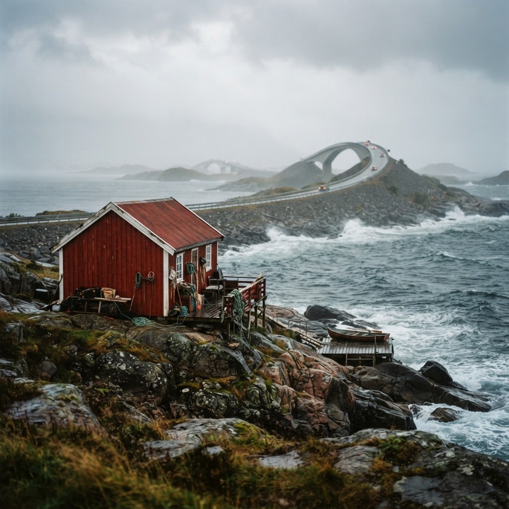
There are several charming fishing villages nearby, such as Bud and Averøy. Staying in a traditional ‘rorbu’ (a fisherman’s cabin) provides an authentic Norwegian experience. These cabins are often painted in vibrant reds and whites, which provide a beautiful color contrast against the dark cliffs and blue water of the coast, adding yet another layer of charm to your trip.
Understanding the Weather Patterns
Norway is famous for its “four seasons in a day” climate, and nowhere is this more apparent than on the Atlantic coast. Even in the middle of summer, temperatures can drop rapidly, and fog can roll in within minutes. When packing, adopt a layered approach. A waterproof outer shell is critical, as is comfortable, non-slip footwear for navigating the rocky terrain near the viewpoints. The unpredictability of the weather is part of the charm; it ensures that your photos of the most Instagrammable road in Norway will be completely unique to your visit. Average summer temperatures range between 12°C and 18°C, while winter temperatures hover just above freezing. Always check the Yr.no weather forecast specifically for the Hustadvika municipality, as coastal conditions are significantly more volatile than inland forecasts suggest. Because light conditions change rapidly, professional photographers often carry a neutral density (ND) filter to manage the high contrast between the bright sky and the dark, reflective ocean surfaces. If you are visiting during winter, you must have studded winter tires on your rental vehicle, as the bridges can develop black ice, which is difficult to spot against the dark asphalt. Dressing in moisture-wicking base layers is essential, as the high humidity near the ocean spray can leave you damp even if it isn’t raining. By respecting the volatile nature of this coastal environment, you gain the opportunity to photograph the road in its most dramatic state: shrouded in low-hanging mist or backlit by piercing, late-afternoon sun.
Capturing the Magic of the Midnight Sun
If your schedule permits, aim to visit between late May and early July. During this time, the sun barely dips below the horizon, creating a surreal, perpetual twilight. This lighting is exceptionally flattering for portrait photography on the bridges. The soft, diffuse light eliminates harsh shadows, allowing you to capture the texture of the rocks and the deep blue of the Atlantic in a way that simply cannot be achieved during the harsher light of the midday sun. The phenomenon occurs because this part of Norway is located at approximately 63 degrees North latitude. The “golden hour” can effectively last from 9:00 PM until 1:00 AM, providing photographers with a massive window of time to capture the road without crowds. If you are shooting during this period, set your camera’s white balance manually to ‘Daylight’ or ‘Cloudy’ to prevent the camera from over-correcting the warm, amber glow of the midnight sun. Many locals consider this the most magical time to drive the route, as the wind speeds often drop to their lowest levels during the overnight hours, resulting in perfectly still water reflections beneath the bridge pylons. Planning your itinerary around these late hours also avoids the peak bus traffic, ensuring you can park at the Storseisundet lookout without obstruction. For those using a drone, be aware that flying is prohibited near certain viewpoints due to safety and privacy regulations; always look for the ‘no drone’ signage at each rest area.
FAQ
Q: Is the Atlantic Ocean Road toll-free?
Yes, the Atlantic Ocean Road is currently toll-free for all vehicles. While there were historical tolls used to finance the construction of the bridges, these were fully paid off, and the route is now part of the public road network accessible to everyone without charge.
Q: How long does it take to drive the Atlantic Ocean Road?
The drive itself takes about 20 to 30 minutes without stopping, covering 8.3 kilometers. However, most visitors should budget 2 to 3 hours to allow for stops at the four designated viewpoints, photography, and coastal exploration along the way.
Q: Can you drive the road in an RV or caravan?
Yes, you can drive the Atlantic Ocean Road in an RV or caravan as it is a public highway. The roads are well-maintained, but they are narrow in sections, so ensure you drive cautiously and utilize the designated pull-offs rather than stopping on the bridge itself.
Q: What is the best time of year to visit the Atlantic Ocean Road?
The best time depends on your goal: summer (June–August) offers the Midnight Sun and better weather for general touring, while autumn and winter (September–February) provide the most dramatic, moody photography opportunities for capturing stormy waves.
Q: Are there restrooms available along the route?
Yes, there are well-maintained public restrooms and facilities located at the main viewpoints and rest areas, such as Eldhusøya. These facilities are free to use and are usually maintained as part of the Norwegian National Tourist Route program.
Leave a Reply